A NANFA
Trip in Central Georgia, April 2004
by Steven A. Ellis
photos by David Ramsey
unless noted
Saturday, April 3, 2004, the NANFA GA Region kicked off the spring collecting season with a visit to the central part of the state. After two straight years of beginning in Okefenokee we decided to give the great swamp a rest and explore other areas. We met at the McDonald’s in Forsyth, GA, at the appointed time of 8 AM and lingered until 8:45 for late arrivals before assembling the caravan for our first stop. The group consisted of: Charles Ray (Auburn, AL), David Ramsey (Lawrenceville, GA), Laura Burbage (Athens, GA), Michael Wolfe & his son Andrew (Athens, GA), Paul Harney (Clermont, GA), Geoff & Julie Kimber with sons Daniel, Noah, & Samuel (Lexington, KY), and Steven Ellis (Kennesaw, GA).
It was a day of perfect weather, excellent company, and surprisingly few fish. The trip was intended to contrast differences in collecting above and below the fall line, but apparently the fish didn’t get the memo. None of us had any recent prior experience at the target sites and my higher expectations were based on past successes in neighboring areas. It was only the second organized collecting trip for Laura. We delighted in her enthusiasm and in imparting some of the tricks of the hobby that have become familiar to the rest of us. In return, she shared her expert knowledge of plants and provided a plant report for each site.
Yellow
Creek (Ocmulgee drainage) –
Just south of Forsyth, GA, on GA Highway 42
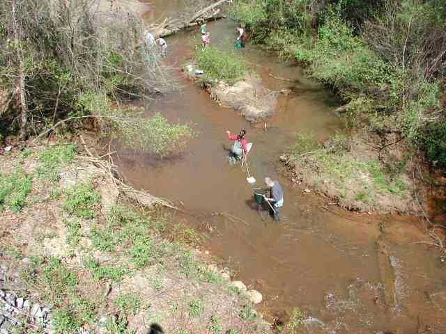
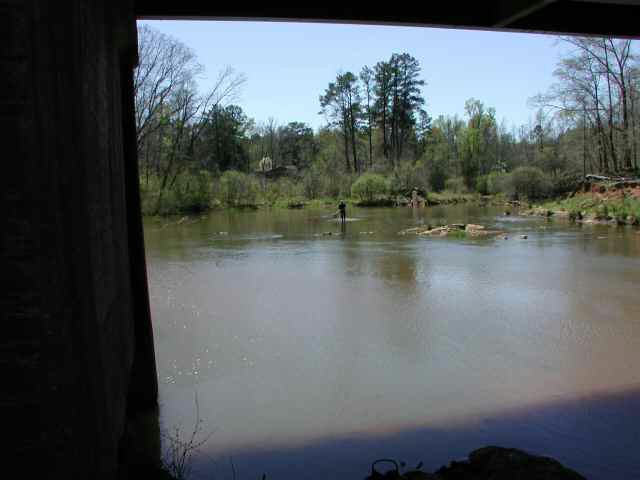
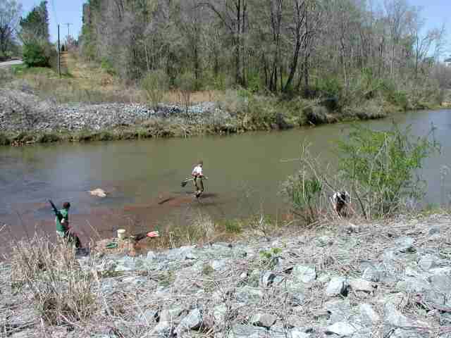
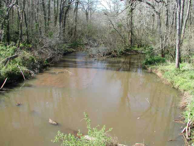
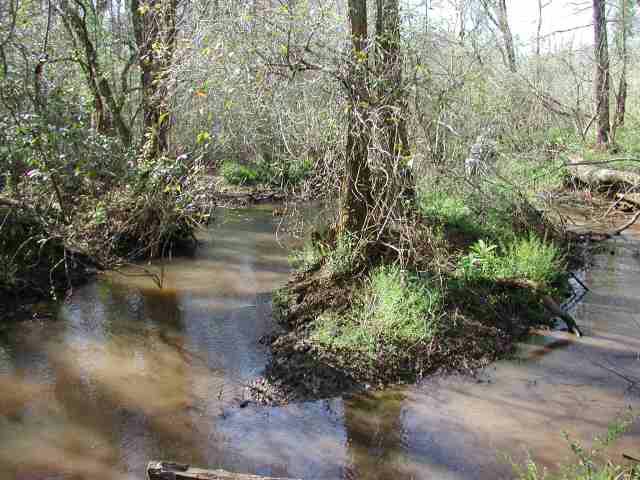
In terms of actual numbers, our first location was probably the most productive. Although it wasn’t immediately apparent from the bridge, the big surprise was the clarity of the water. It would have been fine for snorkeling if the water had been just a bit warmer. David measured the water temperature at 57F. It was a narrow stream with a substrate of muddy clay covered by a layer of sand. There was not a lot of overhanging vegetation. The grassy banks led directly to an open forest not yet clogged by a lot of undergrowth. Beavers had constructed an impressive dam just upstream from the bridge.
(Click on a thumbnail image to display a larger image.)
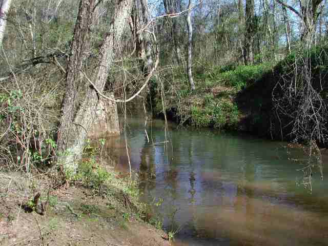 Yellow Creek near Forsyth, GA |
 Yellow Creek, looking upstream (Photo by Michael Wolfe) |
 Yellow Creek, looking downstream (Photo by Michael Wolfe) |
 Working the banks at Yellow Creek. |
||||||||
 L-R: Steven, Michael Wolfe (Athens, GA), Andrew Wolfe (Athens, GA), Geoff Kimber (Lexington, KY), Laura, Paul Harney (Clermont, GA), & Charles. |
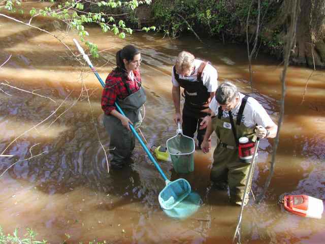 L-R: Laura Burbage (Athens, GA), Steven Ellis (Kennesaw, GA), & Charles Ray (Auburn, AL) |
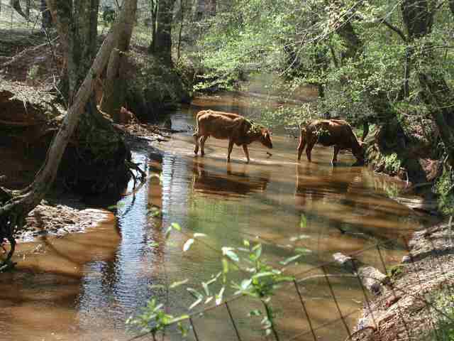
One of the potential reasons for the scarcity of fish became apparent when a small herd of cattle joined us in the creek. We left shortly after their arrival. |
|
||||||||
![]()
|
|
 Bluegill Redbreast sunfish Spotted sunfish Largemouth bass Turquoise darter (females only) Grayfin redhorse 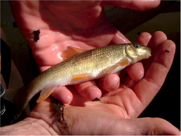 Grayfin redhorse (Photo by Michael Wolfe) Bluehead chub Ocmulgee shiner Yellowfin shiner 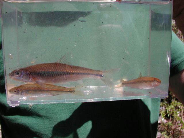 Yellowfin shiners Of course, we found lots of crayfish. |
HERBS (low density at this site) SHRUBS TREES VINES |
|
Water temperature 57F |
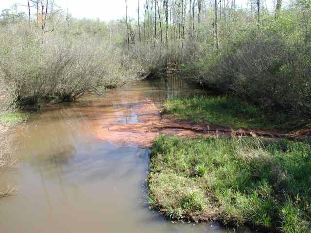
Little Tobesofkee Creek (Ocmulgee drainage) –
2 miles south
of Yellow Creek on GA Highway 42
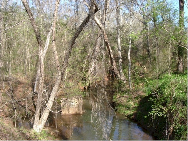
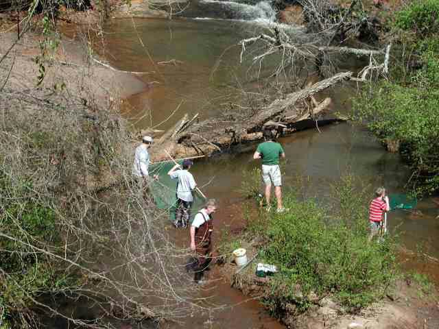
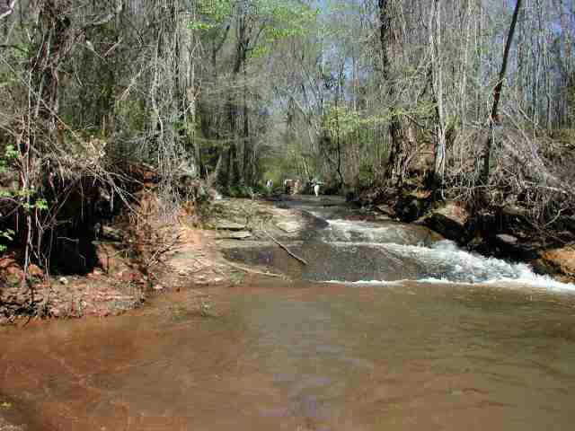
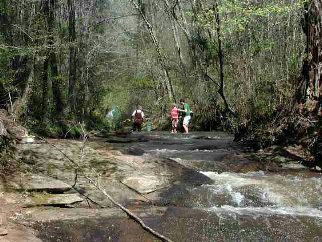
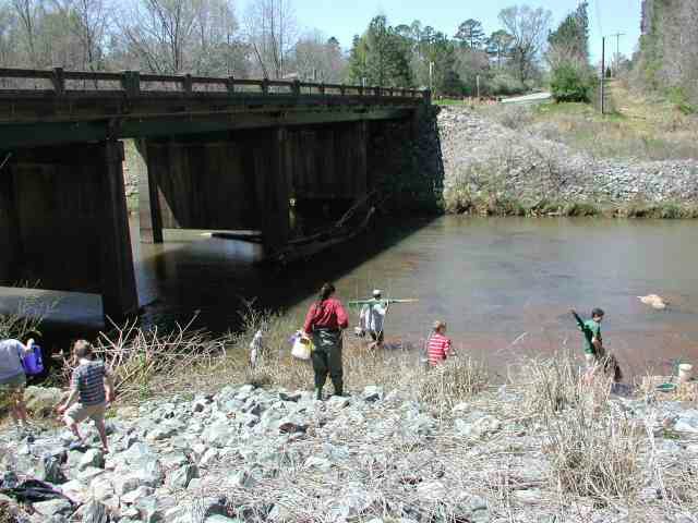
A little wider and somewhat less muddy than Yellow Creek, Little Tobesofkee Creek better illustrated the descent from the fall line. Just upstream from the bridge where we entered was a multi-level waterfall crashing over a stone face into a sandy pool below. It was very similar to the one we discovered at Panther Creek on our ’02 Tallulah Gorge trip.
 Little Tobesofkee Creek, upstream from the bridge |
 Li'l Tobesofkee Creek |
 L-R: Michael, Andrew, Steven, Geoff & his son Daniel. |
|||||
 The falls at Li'l Tobesofkee Creek. |
 A closer look at the falls |
Andrew works the base of the falls. (Photo by Steven A. Ellis) |
|||||
|
L-R: Laura, Paul, Charles, David, & Michael (Photo by Steven A. Ellis) |
Geoff sharing the craft with his son. (Photo by Steven A. Ellis) |
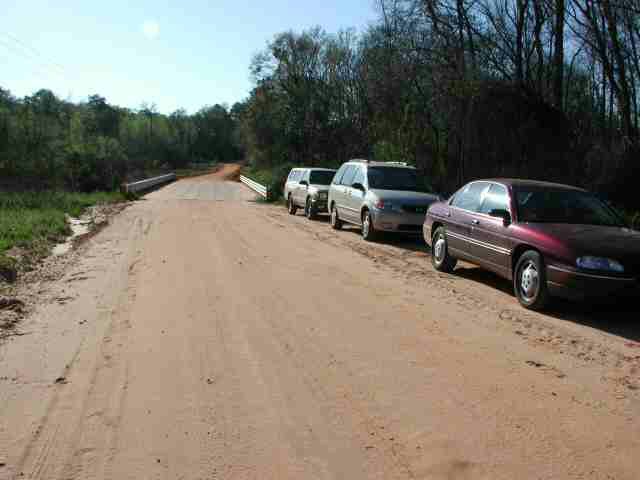
Loading up for the next stop (Photo by Steven A. Ellis) |
|||||
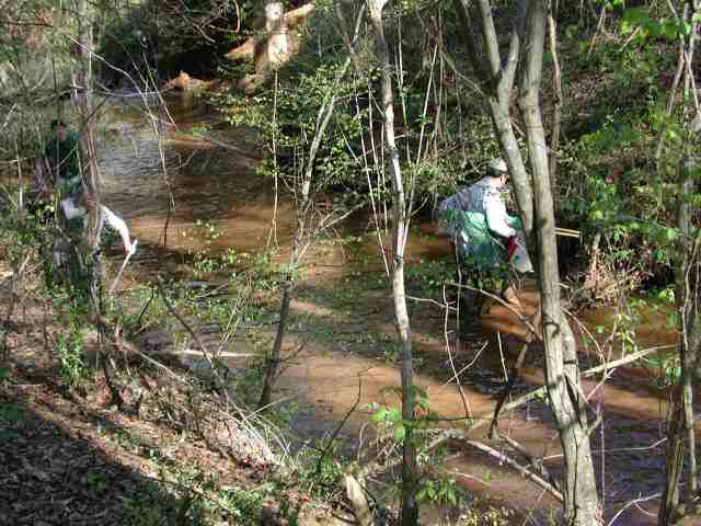
Michael and Andrew anchored the seine against the current while some of the rest of us kicked into it expecting a fair catch of darters. If the darters were there they skillfully eluded us. Seining the wide pool beneath the falls Michael and I only captured about three shiners and a chub. Further downstream, Charles bagged some juvenile madtoms. We were uncertain of the species but since only two were in range they had to be either speckled or tadpole madtoms. The creek also bore evidence of cattle.
![]()
|
Bluegill Redbreast sunfish Largemouth bass Turquoise darter (females only) 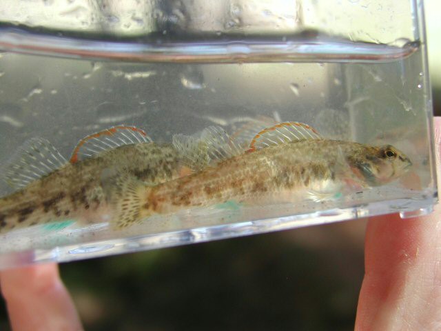 Female turquoise darters Grayfin redhorse Bluehead chub Yellowfin shiner Ocmulgee shiner ? madtom ?  Madtom (Micheal Wolfe photo) fence lizard 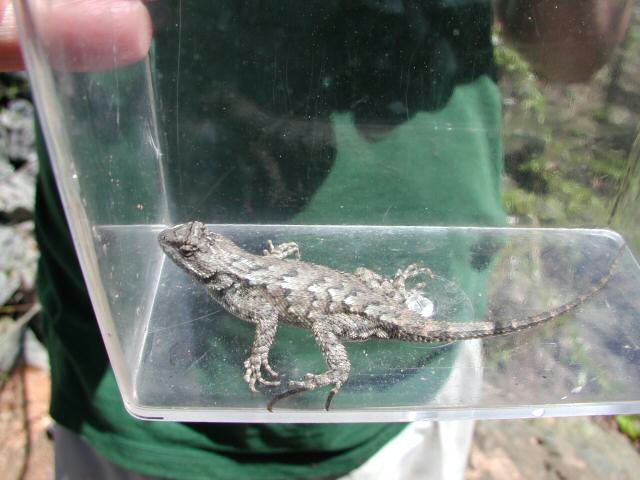 (David Ramsey photo)
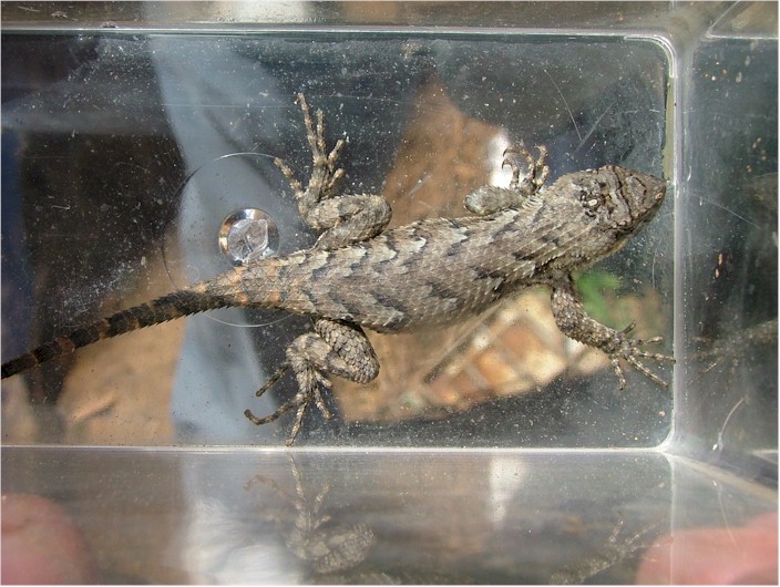 (Geoff Kimber photo)
Fence lizard (Sceloporus undulatus) |
 Vegetation was restricted to the upper banks of the stream and above. Somewhat shady system. HERBS SHRUBS TREES VINES |
Water temperature 55F
|
Tobesofkee Creek (Ocmulgee drainage) – GA Highway 74 approximately 15 miles west of Macon
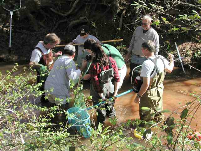
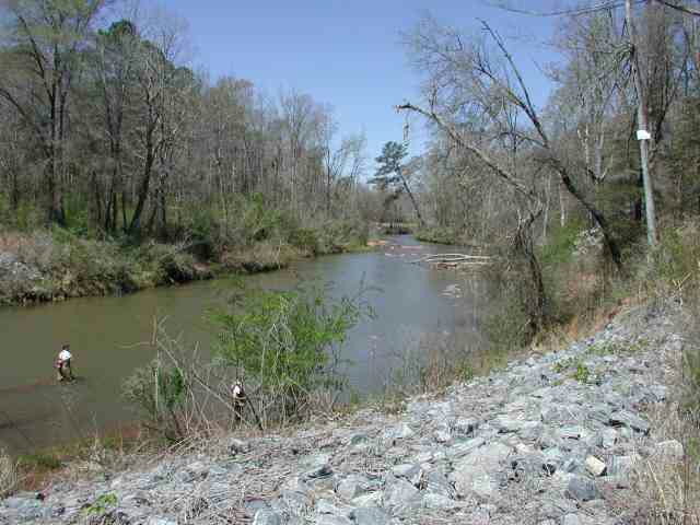
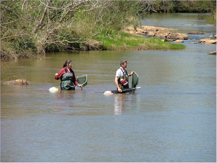
Determined to hit the third site above the fall line before lunch, we headed further south on GA Highway 42, then east on GA Highway 74 until we came to Tobesofkee Creek. Both of the creeks we had just visited drain into this one just a few miles upstream of where we worked it. This one was very wide (by comparison), deep in places, and possessed a significantly stronger current. The water clarity was not great and, according to Geoff who braved it without waders, it was colder. Less than ten feet out from the bank in the deeper water the combination of moderate current and an unstable bottom made it difficult to safely wander out too far. Broken shelves of stone allowed us to cross in just a few places. Otherwise, most of the work was done with dipnets close to the grassy banks.
 Tobesofkee Creek upstream from the bridge |
 Tobesofkee Creek downstream |
 Tobesofkee Creek, upstream (Photo by Julie Kimber) |
 Steven finds solid footing |
||||||
 Waiting for the drop-off |
 Beginning the assault on Tobesofkee Creek |
 Laura & Charles at Tobesofkee Creek (Geoff Kimber photo) |
|
 Tobesofkee Creek (Photo by Julie Kimber) |
|||||
![]()
|
|
Bluegill Warmouth Redbreast sunfish Spotted sunfish Christmas darter Grayfin redhorse Bluehead chub 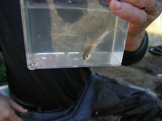 Bluehead chub Yellowfin shiner Ocmulgee shiner Eastern river cooter Eastern river cooter |
HERBS SHRUBS TREES VINES |
 Water temperature 56F TDS 28 pH below 6 Nitrates 0 |
Before we packed up the gear and headed south in search of barbecue for lunch, we said goodbye to the Kimber family who had already been on the road for a week enjoying spring break. We planned lunch at Perry, GA, and jumped on I-475 near Macon with that intent. In the lead vehicle, I noticed after awhile that the Michael’s jeep was missing from the caravan but since nobody was flashing lights or anything I plodded on toward Perry. Just before we got there I saw the blur of a fast-moving jeep in my rear-view mirror as it re-joined our group.
At the second exit in Perry, with semi-accurate directions from a local store clerk, we found a Sonny’s Barbecue. We also learned that Michael & Andrew had stopped for gas when the rest of us had entered the freeway and set a new land speed record catching back up to us. We enjoyed a fine meal and attempted to convert Laura (a native Bostonian) to good ‘ol Southern sweet tea, but she just wasn’t having any. :-) Michael & Andrew decided to bail out after lunch to make sure they were home in time to watch GA Tech (Michael’s alma mater) eliminate Oklahoma State from the NCAA Tournament’s Final Four.
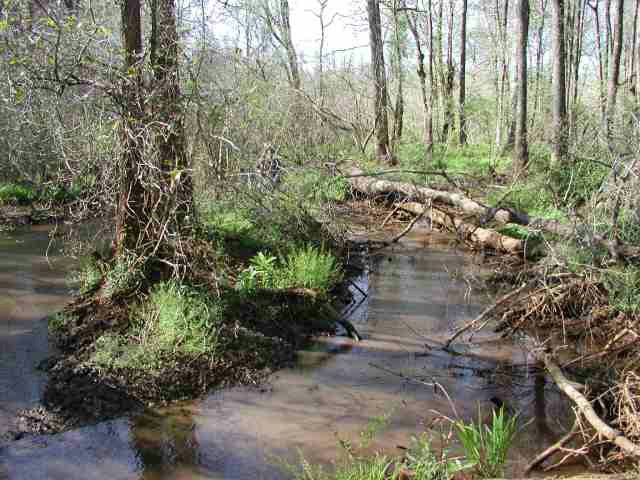
Beaver Creek (Flint drainage) – 18 miles south of Ft.
Valley, GA, on Barrons Lane just east of GA Highway 49
Beaver Creek was our final stop of the day and the only one below the fall line. As expected, the water was muddy. Descending beneath a bridge sporting the words, “I Love Pam,” we did not immediately find any easy way into the water. Standing atop the ruins of a former bridge, Charles could not even find the bottom with the full length of his dip net. I didn’t fare any better from the bank.
 Beaver Creek upstream from the bridge |
 Beaver Creek downstream |
 Beaver Creek, upstream, right fork |
|||
 Beaver Creek, upstream, left fork |
 Road construction added to the siltation problem at Beaver Creek. |
||||
Laura, Paul, and I cut through the brush and moved upstream where the creek split into several forks. It was more shallow there but the mud at the bottom was treacherous. False bottoms gave away suddenly with a rush of bubbles to the surface and dipnets quickly became walking sticks. There were no visible cattle but we did see wild hog tracks in the mud near the water. It would have been extremely difficult to employ a seine under such tough conditions so we all opted for dipnets.
I found Charles downstream from the bridge. He had found a small drainage ditch from the roadside that provided him an alternate entrance to the stream. Where it joined the water heavy siltation from the road formed a sandbar that reached halfway across the stream. Obvious recent widening of the road appeared to have had an adverse affect on the creek. More deep water and tricky mud made collecting tedious in this area as well.
![]()
|
|
Bluegill Warmouth Redbreast sunfish Spotted sunfish Blackbanded darter 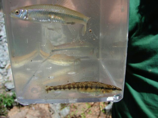 Blackbanded darter (bottom) Bluestripe shiner darter ? Pirate perch Gambusia ? madtom |
Floodplain area. Shrubs along the lower banks. Very shady. I was tired at this point and don’t remember much. Here’s what I remember... HERBS SHRUBS TREES VINES |
Water temperature 58F |
With daylight growing scarce, we loaded up and headed back to I-75 for the trip home, with the exception of Charles, who turned west toward his beloved Alabama. David Ramsey provided the water measurements and the plant report is courtesy of Laura Burbage. Thanks to all who made the trip so much fun.
All the Best,
Steven A. Ellis
GA NANFA Rep.
Kennesaw, GA